Early spring can be a rough time for hikers and lovers of the outdoors here in Central PA. The snow is melting, leaving the trees bare and brown, but the first green signs of spring’s arrival haven’t surfaced yet. It would be easy to give up on getting outside until the last vestiges of winter finally disappear.
Here’s a tip though: Don’t give up! This time period also offers hikers a unique opportunity to take advantage of beautiful ridgeline hikes before the summer foliage envelops the 360 degree views.
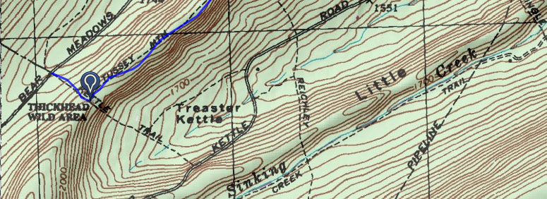
One great ridgeline hike is the Tussey Mountain Trail, a favorite among mountain bikers that hasn’t really caught on with hikers. Jump on the trail from Bear Meadows Road, past the Tussey Mountain ski lodge and Galbraith Gap. Look for a small gravel parking spot on your right and a sign for Kettle Trail on your right, a short spur trail which will lead to the Tussey Mountain Trail. At the intersection, head left — the flat, rocky trail will lead you along the ridgeline, with views of Thickhead Mountain to the right, and Little Flat and Galbraith Gap to the left.
After about 1.5 miles, you’ll pass through a burn zone, the product of a 2006 wild fire. And while the scorched trees are a reminder of the dangers of human interference in the forest (the fire was a result of a downed power line), the recovering ecosystem also provides eerie, expansive views that aren’t easy to find elsewhere in PA.
At mile 2.6, you reach a gas line that provides views to the south. Explore the area more by hiking down the pipeline or on nearby jeep road trails (if you do, remember to bring a map — my favorite is the Purple Lizard topo map). To return to your car, simply retrace your steps.
Leave a Reply